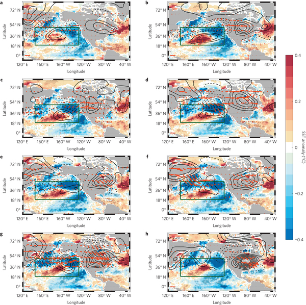
Pacific Extreme Pattern April 6, 2016 600 × 598 Pacific Extreme Pattern The development of the Pacific Extreme Pattern from 50 days (a) to 0 days (h) in 10 day increments. Contours indicate the height of 300 mb, an indicator of a warm air mass (ie. more contours closer together = hotter). (McKinnon et al. 2016)